Lightning fast. Highly accurate. Computer vision solutions.
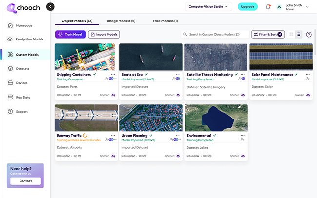
Chooch’s computer vision platform helps businesses deploy AI quickly using ReadyNow solutions or build their own AI models that eliminate hours of manual video review and analysis work while expediting accurate results.
- Reconnaissance
- Public safety
- Crisis mitigation
- Higher revenue
Why Computer Vision for Geospatial Analysis?
The explosive growth of imagery from satellites and UAVs creates heavy workloads for analysts. Using dense classification, object detection, and rectangular and polygonal segmentation techniques, the Chooch AI Vision platform analyzes millions of images in real time. Governments, militaries, and businesses can easily process, analyze, and benefit from their images and video – putting the data to profitable use.

Increased Public Safety
Edge AI installed on satellites or aircraft accurately identifies wildfires, accidents, and citizens stranded in natural disasters. Real-time alerts help decision-makers take immediate action, decreasing response time and empowering damage control.

Change Detection
AI Vision detects even minor differences in deforestation, water level changes, urban sprawl, melting glaciers, and industrial activity. Granular details such as percentage change estimates in building damage are accurately tracked and measured.

Multi-sensor Imaging Analysis
Faster and more accurate than the human eye, AI Vision provides ongoing analysis of electro-optical, infrared, and synthetic aperture radar from any source. Advanced video training procedures can generate thousands of annotated images per minute, identifying objects on the ground in under a tenth of a second.

Detailed Earth Monitoring
Deep-learning computer vision can monitor everything from urban development to population dynamics to climate change, helping organizations create strategies for a healthier, sustainable world.

Environmental Epidemiology
Public health researchers can process a wide range of data points and translate them into smarter insights for population health and disease prevention.

Intelligence and Reconnaissance
AI Vision can quickly interpret geospatial data for military intelligence and surveillance applications, providing valuable insights on aircraft, weapons, and other objects of study.

Easy Integration and Installation
Chooch AI integrates with aircraft, UAVs and satellites alike, with models that store thousands of classes as embedded vision on GPUs — making them lightweight and easy to install on a variety of observation vehicles.
See how Computer Vision for Geospatial Analysis applications can help you
Reach out today and schedule a demo to see the power of Chooch’s AI Vision solutions.

