SOLUTIONS / PUBLIC SECTOR
AI for Military, Intelligence, and State Agencies
Transform and leverage your video and image data into decision advantage using Computer Vision and Generative AI.
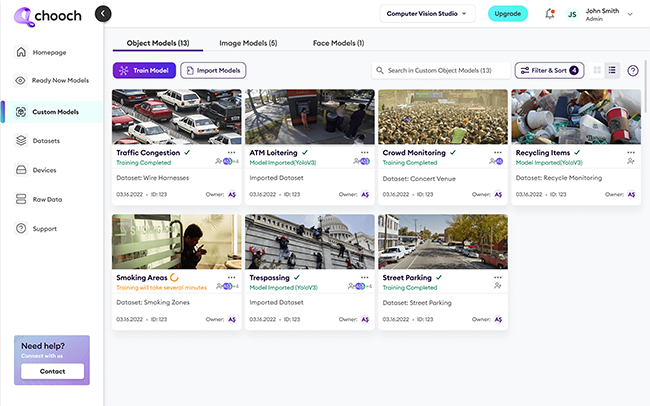
A full stack computer vision platform to quickly attain mission-ready AI
From aerial images to sizes of ground motor vehicles, Chooch AI Vision supports any mission. Accurate, wide-ranging surveillance helps departments achieve more situational awareness with fewer demands on staff, helping them complete their missions at a lower cost.
- Surveillance
- Productivity
- Data Security
- Public safety
Why AI Vision for the Public Sector?
Government contractors and public sector organizations are tasked with translating video data from an ever-growing volume of satellites and vehicles into actionable insights. Chooch AI Vision can quickly analyze full motion video and images, reducing analysts’ heavy workload and launching real-time action. Governments, militaries, and contractors can protect their data, strengthen security, and offer faster public service through AI Vision’s advanced capabilities.

Automated Monitoring
Chooch AI Vision for full motion video and image monitoring with pixel-level detection accuracies. In addition to being more accurate than the human eye, AI Vision can guard more territory than security staff who can only monitor a few streams at a time.

Pattern Detection
Chooch automatically inspects EO/IR/SAR imagery and detects patterns such as human life, temporal/heat maps, and multi-domain changes – helping public sector leaders make smarter decisions in shorter timeframes.

ML-Assisted Annotation
Chooch AI Vision provides unlimited data annotation, helping organizations scale faster while freeing workers to focus on more meaningful work. Self-hosted AI Vision allows full data sovereignty instead of relying on third-party AI data labeling services, which can compromise security.

Searchable Unstructured Data
Chooch creates indexed objects, text, and facial detection predictions for fast analysis and reporting – so searching and analyzing unstructured data is never a problem.

Geospatial Intelligence Analysis
Chooch AI Vision quickly interprets geospatial data for military intelligence and surveillance applications, providing valuable detail on aircraft, weapons, and other objects of study. Integrating easily with aircraft, UAVs and satellites, AI Vision detects multiple objects at different resolutions, with processing capabilities for on-asset/local geospatial intelligence production.

Increased Response Time
Edge AI installed on satellite or aircraft accurately identifies natural disasters, military strikes, and troop maneuvers, with real-time alerts to launch faster responses.

Easy Integration and Installation
Chooch AI integrates with aircraft, UAVs, and satellites alike, with models that store thousands of classes as embedded vision on GPUs— making them lightweight and easy to install on a variety of observation vehicles.
Learn more about AI Vision for the Public Sector
Reach out to our AI experts and find out how AI Vision can help you.

