Over the past few years, the drone industry has witnessed a significant evolution with the integration of advanced technologies, particularly computer vision. This shift has brought many opportunities for drone service providers, enhancing their capabilities, and creating great value in agriculture, construction, and military operations. We’re now on the brink of an intriguing era where autonomous drones can execute complex tasks such as geospatial analysis and aerial surveillance with remarkable efficiency and precision.
Consider a future where drones, armed with advanced computer vision, capture detailed thermal images and autonomously interpret them through high-performance thermal image analysis software. It’s a future where visual data management and analysis become smooth, automated processes, clearing the path for more effective operations across various sectors.
In this blog, we’ll explore the realm of drone computer vision and image processing and the opportunities they present to drone service providers. From drone inspection to automated visual inspections, we will highlight the benefits and potential of these forward-looking technologies in reshaping the drone industry.
So, get your radio controller ready, and let’s set off on this insightful expedition into the future of drones, where the sky’s not the limit. Stay with us as we uncover the untapped potential of drone technology, and together we’ll see how computer vision is on its way to redefining how we perceive and interact with the world around us.
Deriving intelligence from drone visual data with computer vision
At the core of modern drone technology lies computer vision algorithms, empowering drones to navigate, interpret, and interact with their surroundings autonomously. By enhancing the precision and reliability of drone navigation systems, computer vision facilitates autonomous drone flights and real-time decision-making.
Another advantage of computer vision algorithms is enhanced sensing. These algorithms amplify visual data processing from cameras, enabling drones to detect and respond to obstacles, identify and track targets, and make more informed decisions. in the result is improved object recognition, a particularly handy feature for delivery, inspection, and search and rescue operations applications.
Furthermore, computer vision algorithms are pivotal in optimizing drone operations and improving efficiency, leading to lower energy consumption, longer flight times, and more advanced drone performance.
Image processing: The drone’s window on the world
Image processing techniques powered by computer vision technology are instrumental in enabling a drone’s understanding of its environment. By leveraging propulsion and navigation systems, sensors, cameras, and GPS technology, drones can avoid obstacles and zero in on their destinations.
Several image annotation and segmentation techniques are used to train drones for aerial imaging. These techniques enable drones to recognize, track, and avoid objects during flight, thus improving drone accuracy and providing a richer visual representation of the environment.
Enabling drones with computer vision AI: Common use cases
Computer vision and AI together have unlocked an array of possibilities for drone use across a variety of sectors. This technology transforms traditional operational methods, offering better efficiency, accuracy, and safer alternatives to manual procedures.
Here are some expanded examples:
Monitoring telecom infrastructure
Drones equipped with AI and computer vision are revolutionizing the telecom industry. They can autonomously inspect vast telecom infrastructures, identifying issues such as defective Radio Access Network (RAN) units. This ensures consistent network performance and reduces downtime. Additionally, these drones can conduct pipeline security inspections, identifying potential leaks or damage, especially in areas that are difficult to reach or inspect manually.
Wildfire detection
One of the more novel applications is fire detection. Using thermal cameras and computer vision algorithms, drones can swiftly detect and report heat signatures indicative of fire, helping prevent minor incidents from escalating into more significant disasters.
Detecting railway maintenance and hazards
AI-powered drones provide an innovative solution for maintaining and monitoring railways. They can capture high-resolution images of tracks, identify potential hazards, and assess track integrity. By leveraging computer vision algorithms, these drones can detect structural abnormalities or debris and send accurate location data to facilitate quick repair and maintenance.
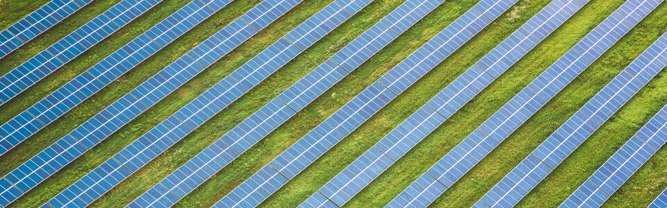
Monitoring solar infrastructure
Drones, equipped with thermal cameras and AI, play an increasingly important role in renewable energy. They can scan vast solar farms and use real-time image processing to detect anomalies in solar panels. AI algorithms allow drones to autonomously interpret the captured thermal data, identifying underperforming panels for quick maintenance and repair.
Perimeter detection
Drones powered by computer vision are becoming a cornerstone of perimeter detection and surveillance. They can patrol boundaries and detect potential intrusion attempts, serving as an invaluable security asset. These drones can differentiate between bystanders and potential threats, reducing false alarms and ensuring more accurate security responses.
End-to-end drone solutions: The aim
Many companies in the drone industry strive to provide comprehensive, end-to-end drone solutions. They integrate everything from flight planning and data capture to data analysis and reporting. They also incorporate advanced technologies such as computer vision and machine learning to enhance drone performance and efficiency, making drones even more versatile across various industries.
Integrating computer vision into drone technology is transforming what drones can do and extending their potential applications. Drones have become invaluable tools in various industries, from image processing and geospatial analysis to visual data management and automated visual inspections. As drone technology continues to evolve, the sky is truly the limit for what these versatile machines can achieve.